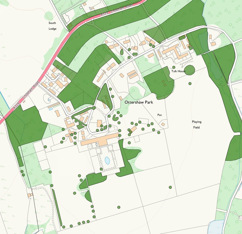
Runnymede Borough Council Tree Preservation online map.
This map shows the trees covered by Tree Preservation Orders (TPO's)
in and around the Ottershaw Park.
(For fully interactive version go to the http://maps.runnymede.gov.uk/website/maps/index.html#
and click on Tree Preservation Orders and zoom in)
|
|
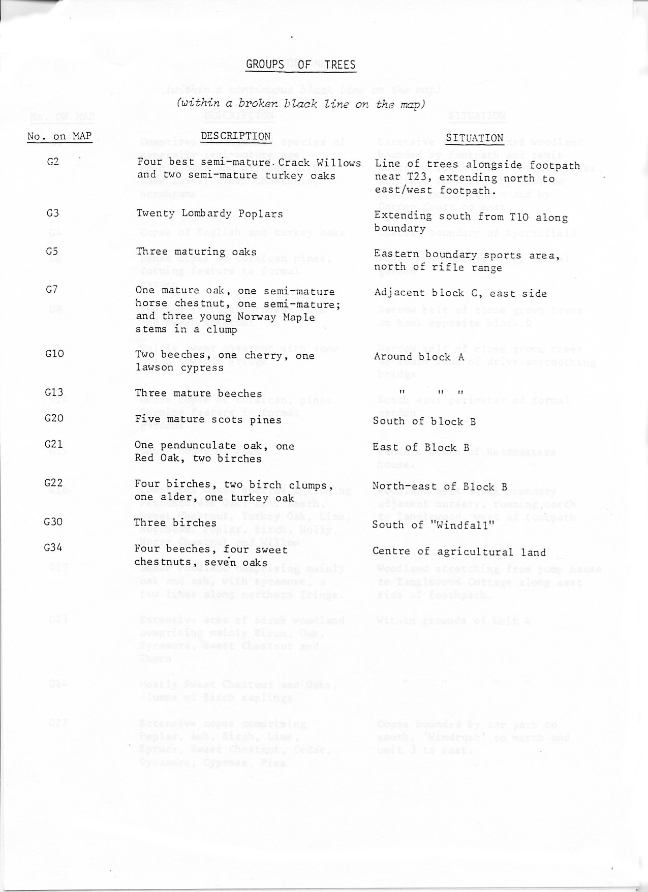
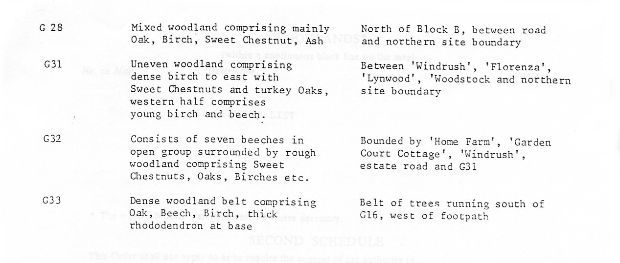
Map from Runnymede Borough Council Tree Preservation Order No. 69 (1981)
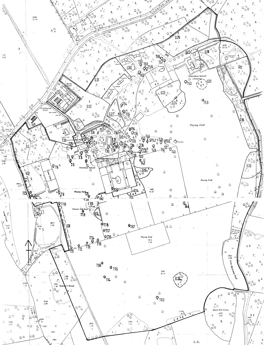 |
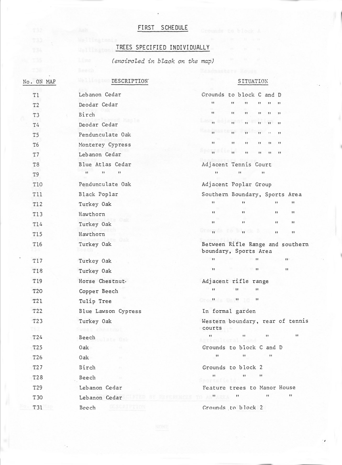
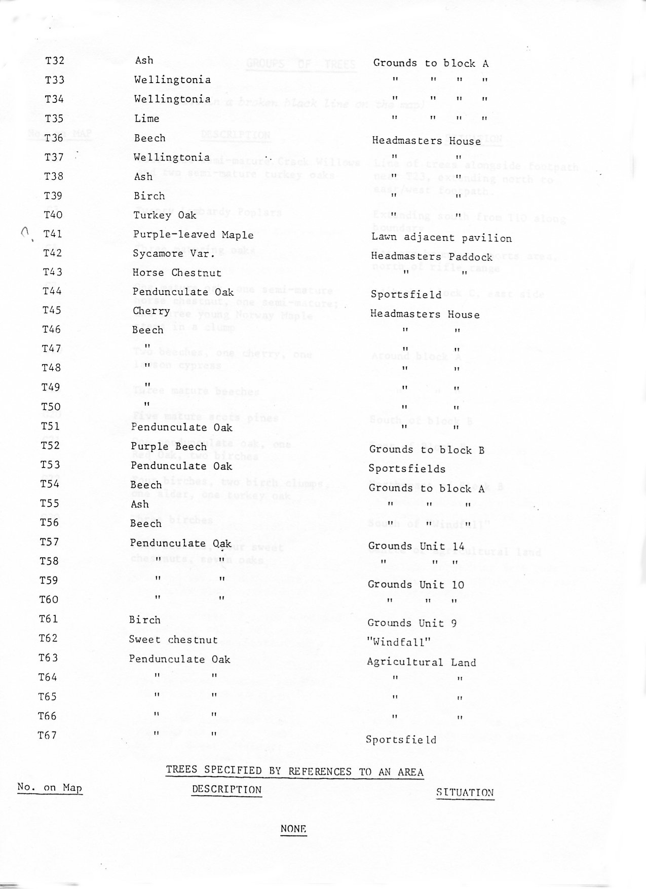
List of trees on the TPO
References to some location relate to buildings and ownership as they were in 1981 when the TPO was drawn up. We plan to provide an updated to guide to trees listed by OPEC address. Note also that many of the trees have been been felled since the map was drawn.

 00">
00"> |